St. George Terminal Masterplan
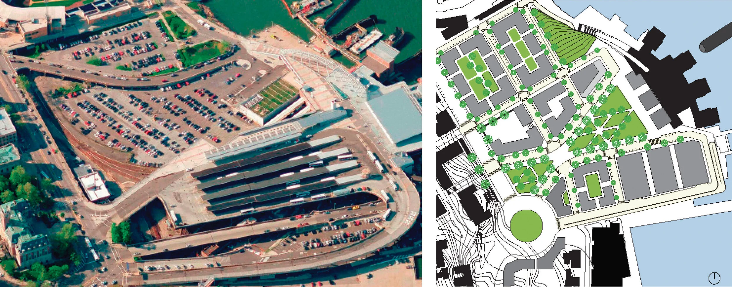
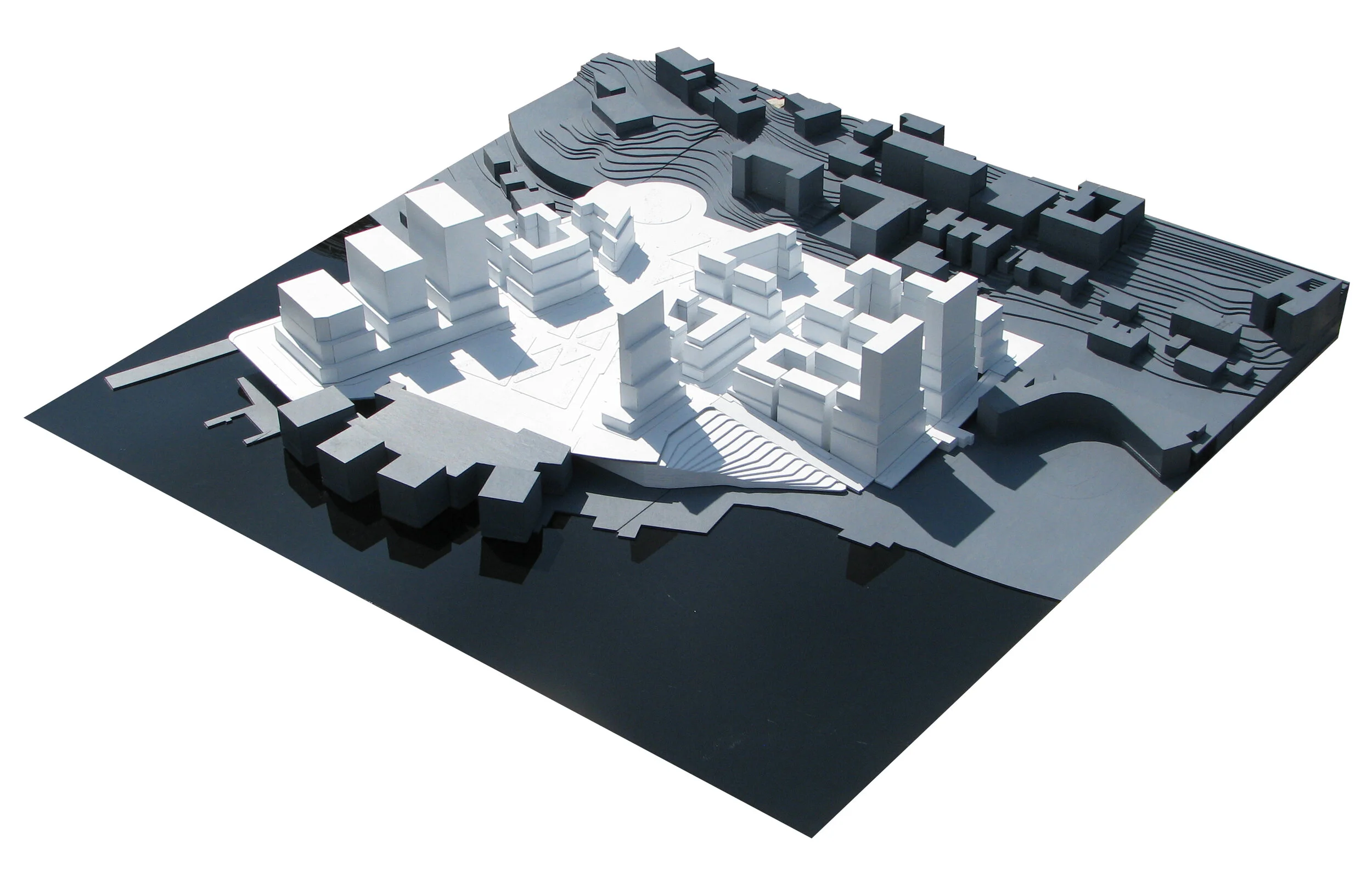
Existing Site and Proposed Plan
The site is located at the St. George Ferry Terminal in the northeastern tip of Staten Island. Its bounds are the ferry terminal, the waterfront street, Richmond Terrace, and the Richmond County Bank Ballpark.
The principal features of the site are a 30’-0” retaining wall along the northwestern edge of the site, dropping down from Richmond Terrace, forming a “crater” condition between the street and the terminal. The crater is partially covered by a deck for bus platforms, as well as a network of access ramps. The ground level is used for municipal and private pay-parking.
The partí of this thesis is twofold: 1) extend the existing SW-NE streets and mirror the NW-SE streets over the present waterfront street; 2) extend the geometry shaping the berths of the ferry terminal. This strategy carries the existing urban fabric into an area where there is none, which is further shaped by the regulating lines of the terminal.
The subsequent design redirects the current traffic pattern into a more pedestrian-conscious form and proposes use that will rejuvenate Staten Island’s currently lifeless boundary into a vibrant destination for both residents and visitors.
Credits
Firm:
Title / Role
Firstname Lastname
Title / Role
Firstname Lastname
Title / Role